Accelerate Productivity in 2025
Reignite Growth Despite the Global Slowdown
Staying ahead of the technology curve means strengthening your competitive advantage. That is why we give you data-driven innovation insights. This time, you get to discover 5 hand-picked geospatial intelligence (GEOINT) solutions.
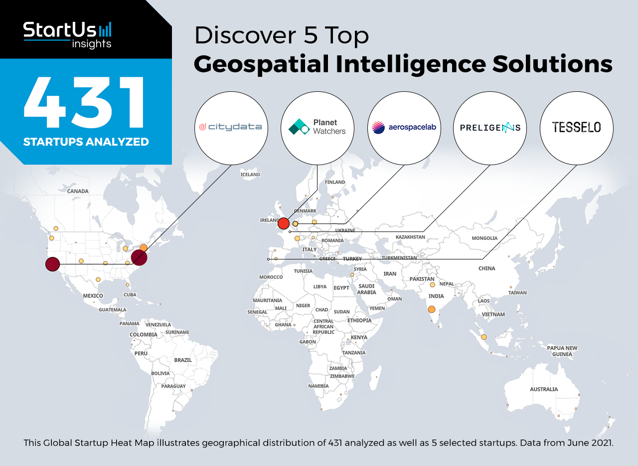
Global Startup Heat Map highlights 5 Top Geospatial Intelligence Solutions out of 431
The insights of this data-driven analysis are derived from the Big Data & Artificial Intelligence-powered StartUs Insights Discovery Platform, covering 2.093.000+ startups & scaleups globally. The platform gives you an exhaustive overview of emerging technologies & relevant startups within a specific field in just a few clicks.
The Global Startup Heat Map below reveals the distribution of the 431 exemplary startups & scaleups we analyzed for this research. Further, it highlights 5 startups that we hand-picked based on criteria such as founding year, location, funding raised, and more. You get to explore the solutions of these 5 startups & scaleups in this report. For insights on the other 426 geospatial intelligence solutions, get in touch.
Aerospacelab provides Trade Flow Monitoring
Most of the world’s trade takes place through the shipping industry. Thus, a snapshot of activity in the industry is a good indicator of economic activity globally. However, solutions that integrate and analyze data from thousands of freight ships and seaports are limited due to a lack of detailed ground data. Geospatial intelligence solutions overcome this challenge by monitoring the movement of all vessels across the world in real-time.
Belgian startup Aerospacelab uses high-resolution satellite data to provide geospatial intelligence. It models the real-time movement of goods and people across ports, airports, and other strategic locations. This allows companies to monitor the throughput of manufactured products, hard commodities, and energy commodities. The startup’s solutions also find applications in metals, agriculture, finance, and sustainability.
PlanetWatchers enables Crop Insurance
Bad weather and extreme climatic events often destroy large amounts of crops. Crop insurance solutions assist farmers to improve their productivity in the face of uncertainty. However, challenges like limited on-ground data, scattered landholdings, and the inability to accurately assess the worth of a plot’s produce restrict their applications. AgriTech startups develop GEOINT solutions that use satellite data to assess crops for insurance, as well as to enable precision agriculture.
PlanetWatchers is a British startup that utilizes space data for crop insurance. It combines synthetic aperture radar (SAR) data and artificial intelligence (AI) algorithms to identify crop types, age, and severity of the damage. The startup’s solution, PW: Response, reduces the time to analyze damage from storms and floods. PW: CropCycle, another solution, helps crop insurers efficiently report planting dates, acreage, and crop classification.
CITYDATA.ai facilitates Urban Planning
For effective urban planning, cities need to account for trillions of data points on static and dynamic assets. Manually collecting enough data from surveys and existing records is an uphill task for governments and research organizations. On the contrary, geospatial solutions provide urban planners detailed insights on land and infrastructure within a city. This enables smart city applications for all kinds of urban regions, ranging from densely populated city centers to informal settlements.
CITYDATA.ai is a US-based startup that builds digital replicas of cities. The startup’s geospatial AI platform simulates the presence, activity, and movement of people within cities. This provides accurate and actionable insights to government and research organizations, as well as businesses and brands. Through anonymized footfall and activity tracing, the startup enables solutions in public health, mobility, urban planning, and electric vehicle charging, to name a few use cases.
Tesselo offers Land Resource Management
Reforestation and conservation projects are crucial to mitigating the environmental impact of deforestation and urbanization. This is why startups develop sustainable land use solutions for agroforestry, as well as agriculture and smart cities. However, manual monitoring of large tracts of land is labor-intensive and expensive. GEOINT solutions use AI to rapidly scan large amounts of land resources to enable sustainable management.
Portuguese startup Tesselo advances land resource management using satellite images and AI. For the forestry and agriculture sectors, it offers near real-time and country-scale mapping of vegetation cover. This allows foresters to classify trees, measure forest growth, monitor harvests, and predict forest fires. The startup also offers land-use solutions that help businesses become sustainable, as well as comply with local environmental regulations.
Preligens performs Strategic Site Surveillance
Geospatial intelligence also plays a crucial role in continuous reconnaissance against threats to strategic sites. In addition to the sites of defense and military importance, these include large utilities and industrial setups in remote, harsh, or militarized environments. To secure such sites, imagery intelligence (IMINT) solutions gather geospatial data from satellites, reconnaissance planes, and drones.
French startup Preligens offers GEOINT solutions for strategic site surveillance. The startup’s proprietary software utilizes very high-resolution (VHR) satellite imagery to monitor strategic locations such as ports, airports, defense bases, and industrial sites. The IMINT solution leverages both commercial and classified images to detect and identify threats. The startup also offers a multi-intelligence (Multi-INT) platform to combine data from different intelligence disciplines.
Discover more startups
Startups such as the examples highlighted in this report focus on earth exploration, climate change, and ecosystem monitoring. While all of these technologies play a major role in advancing the industry, they only represent the tip of the iceberg. To explore more technologies, simply get in touch to let us look into your areas of interest. For a more general overview, you can download our free Innovation Reports to save your time and improve strategic decision-making.
